Travel and Transportation
Airports
The airport closest to the conference is the San Francisco International Airport (SFO). The Hilton is 14 miles from San Francisco International Airport.
Oakland International Airport in 20 miles from the hotel, and San Jose International Airport is 47 miles from it.
Transportation from SFO

Public Transportion (BART)
Transportation to and from the Hilton is available through the Bay Area Rapid Transit System (BART). Estimated one-way fare is $10 per person and ride time is approximately 25 minutes.
The SFO BART Station is located on the Departures/Ticketing Level of the International Terminal (G Gates side). BART is easily accessed from any terminal by riding SFO’s AirTrain to the Garage G/BART Station stop. There is no charge to board AirTrain. Clipper Cards can be purchased at the SFO BART Station upon arrival.
Taxi
Estimated taxi fare is an estimated $45-$65 (one way). Taxis depart from the designated taxi zones located at the roadway center islands, on the Arrivals/Baggage Claim Level of all terminals.
Uber/Lyft
By Car
From San Francisco International Airport, head northwest toward US-101 N. Follow US-101 N to 7th St in San Francisco. Take exit 1 from I-80E (12 mi). Continue on 7th St to Taylor St (1 mi).
Hilton San Francisco Union Square
333 O’Farrell Street
San Francisco, California 94102
Tel: (415) 771-1400
Website: www.hilton.com
Parking
On-site parking fee is $74.10 per day. Discount available for a limited number of self-parking cars. Valet parking is available.
Public Transportation
BART
Bay Area Rapid Transit, or BART, is one of the San Francisco Bay Area’s most popular forms of public transportation. There are multiple main train lines spanning from different areas like a web. On weekdays, each train runs every 15 minutes, while on weekends, they run every 20 minutes. Before arriving at a BART station, figure out where it is you are trying to go and which station is closest to that destination, using this planning tool.
Muni
Muni is San Francisco’s bus and metro system that runs throughout the city, operating buses, trains, cable cars and the F-line heritage streetcar. Muni buses remain above ground and on streets while Muni Metro runs on rails and sometimes go underground. Bus stops come in many forms: small bus shelters, yellow paint on street poles, and white paint on streets. Metro stops can be found on an island in the middle of the street and in underground stations. Using the Metro Map, find the nearest Metro to your location. Find more information on how to use Muni and Muni Metro.
Cable Cars and Streetcars
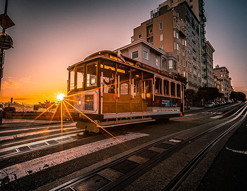
Cable cars and street cars are San Francisco’s historic public transit cars. Cable cars are located downtown and run on three lines: Powell-Hyde, Powell-Mason, and California Street. The F-Line streetcar runs up and down Market Street all the way to Fisherman’s Wharf. Pay the conductor onboard or purchase tickets in advance at multiple locations or via smartphone using the MuniMobile app. Exact change is your only option when you are onboard the vehicles.

